How can we preserve – or manage – the earth’s ecosystems under increasing pressure from people’s needs? Zoï tries to give answer to this very basic and central question through easily understandable information products both at the global and at the regional level.
We are supporting the Rio conventions on desertification and biodiversity with illustrated ‘bibles’, such as ‘Desertification – a visual synthesis’. At the regional level we help to synthesize the messages of the convention on transboundary waters in Europe and are also producing simple illustrated ‘primers’, such as the ‘Biodiversity in Central Asia’.
More hands-on are our activities of transboundary river basin assessments (Amu Darya, Dniester etc.) under the environment and security initiative.
Zoï Books are produced for the United Nations, the European Union, regions, countries and a growing community of readers world-wide. We closely cooperate with GRID-Arendal in providing environmental information for decision-making.
Our digital library is available here.
Image + Click = e-book
Maps of Central Asia and Switzerland-Europe produced for the high-level conference “Blue Peace Central Asia: Dialogue for 2030 - Water Security and Inclusive Growth” organized by Switzerland in Astana on June 19, 2017.
Maps:
River System in Central Asia (English / Russian)
Switzerland and the European River System (English / Russian)
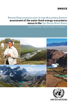
Coordination between the water, energy, food and environment sectors is fraught with difficulties at the national level and the complexity increases substantially in transboundary basins. The “nexus approach” to managing interlinked resources has emerged as a way to enhance water, energy and food security by increasing efficiency, reducing trade-offs, building synergies and improving governance, while protecting ecosystems.
This publication contains the results of nexus assessment of the Syr Darya River Basin, shared by Kazakhstan, Kyrgyzstan, Tajikistan and Uzbekistan, that has been carried out in the framework of the UNECE Water Convention’s programme of work for 2013–2015.
The quarrying of raw materials – such as limestone, shale, sand and gravel – for cement and aggregates production poses significant risks to biodiversity and ecosystems. Building Materials companies and policy makers must work together to find solutions that balance the needs of society, business and nature.
Drawing on the lessons and experience of a multi-year engagement with Holcim, a leading supplier of cement and aggregates, IUCN has developed a series of guidance documents that address the risks and opportunities for biodiversity and ecosystems from quarrying for cement and aggregates. These documents emphasise the distinct but complementary roles that governments and businesses have to play in the conservation and sustainable use of natural resources.
Integrated Biodiversity Management System (IBMS): pdf ebook
Biodiversity Indicator and Reporting System (BIRS): pdf ebook
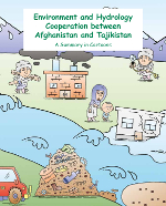
This collection of cartoons illustrates how Afghanistan and Tajikistan cooperate on various environmental issues. Different aspects of this collaboration and the challenges which arise from it are shown in a reader-friendly way through the use of drawings, symbols and explanatory captions.
pdf Dari pdf Russian pdf Tajik
ebook Dari ebook Russian ebook Tajik
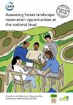
Are you working on land use or conservation policies? Or landscape-level programmes? Perhaps you are involved in the forest, agriculture or energy sector? Are you interested in exploring the potential for restoration and carbon sequestration in your country? Maybe you have been asked to take part in an FLR assessment? Or maybe you are simply curious to learn more about what this is all about.
Zoï has helped IUCN publish a highly visual methodology handbook '"Assessing forest landscape restoration opportunities at the national level". The goal is producing support for restoration and coming to a common vision of how degraded and deforested landscapes can be transformed into healthy and productive systems.
pdf French pdf Portuguese pdf Spanish
ebook French ebook Portuguese ebook Spanish
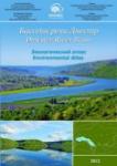
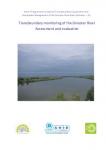
This report presents achievements of the ENVSEC (UNECE/OSCE/UNEP) project “Transboundary Co-operation and Sustainable Management in the Dniester River Basin: Phase III – Implementation of the Action Programme”. The activities were focused on developing and signing the Dniester River Basin Treaty between Moldova and Ukraine, transboundary water monitoring, fish fauna conservation, information sharing on the basin level, public awareness, and reducing vulnerability to extreme floods and climate change. The publication also provides recommendations for further activities in the Dniester river basin.
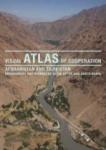
Zoï has contributed to UNECE water assessments and helped facilitate implementation of UNECE and United Nations conventions in Central Asia. Based on its previous work with Afghanistan, Zoï was invited to assist in the facilitation of the Afghan-Tajik cooperation process. In the development of this atlas, Zoï’s special talents for presenting environmental issues visually have been of particular value.
Economic development and natural resource management are top priorities for cooperation between the Islamic Republic of Afghanistan and the Republic of Tajikistan. For both countries the adequate knowledge and sharing of information about natural resources and hazards are important.
With 100 photos and 50 maps and graphics based on official sources and original research, this well-illustrated atlas presents information at the river basin – as opposed to the national – level, and portrays challenges from the regional rather than the country perspective. With the objective of supplementing information already available in each of the countries, the atlas is designed to help local policymakers and experts as well as readers outside the region, donors and the international community understand the basin’s natural resources, common needs and priorities. It starts with brief introductions to the countries, illustrates the Amu Darya River basin as a part of the Aral Sea basin and provides details on the Upper Amu Darya.
Today, environmental crimes amount to more than $100 billion a year. Those high-profit, low-risk crimes are destroying ecosystems, dramatically impacting on climate change and devastating local economies. Nevertheless, they are extremely hard to fight as they are constantly hidden within legal Environmental crimes are not soft crimes. They often occur in countries with a high rate of corruption involving violence and impacting directly on the poorest population. Environmental crimes take full advantage of the financial opacity (tax havens, e.g.) and the weakness of the worldwide transportation system trade, take advantage of tax havens and are mostly controlled by huge criminal organizations such as mafias or illegitimate firms. This brochure provides an overview of the situation, identifies some of the most important points and suggests ways to fight against this global threat.
The Environmental Atlas of the Dniester Basin is the first attempt to present the environmental state of the transboundary river in a visual format which includes over 30 thematic maps of the basin, graphics, diagrams and pictures. The target groups for the Atlas are specialists in environmental protection, as well as the authorities and the population in the Dniester basin.
The Atlas is further supported by the Dniester river basin geo-information system, designed to facilitate strategic and operational decisions in the basin including those related to implementing the New Dniester Basin Treaty signed by Ukraine and the Republic of Moldova in Rome on 29 November 2012.
The United Nations Environment Programme 2011–2013 strategy focuses on six thematic priorities – climate change; resource efficiency; disasters and conflicts; environmental governance; harmful substances and hazardous waste; and ecosystem management. As part of its effort to come to terms with these priorities, UNEP engaged Zoï to create thematic maps for use as objective tools for priority setting in the European region.
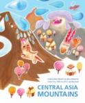
It is easy for lowlanders to regard the mountains as magical places, harder, perhaps, for them to understand mountain culture and the spirit of mountain people, and hardest of all to acknowledge, much less pay for, the astonishing array of mountain ecosystem goods and services on which they rely. Working with the University of Central Asia and local partners, Zoï Environment Network reveals and explains the connections between the mountain environment and the people of the lowlands, and communicates the findings in a popular report that demonstrates the necessity of sustainable mountain development and the opportunities for a green economy.
This report is an illustrated overview of the trends and challenges in sustainable mountain development in Central Asia since 1992. It highlights selected achievements and lessons learned, and identifies opportunities for further progress. The cover page and title of this version differs from the official version released for the Rio+20 meeting, though the contents remain the same.
Reliable information about the environment and in particular water resources is required for the sustainable future of Central Asia. This paper was presented at the UNECE workshop “Managing water information in Central Asia” in December 2011 in Kazakhstan.
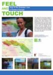
This map by Zoï environment network is a contribution to an international effort to support Ukraine and Moldova in jointly managing their shared Dniester river. Besides being used in numerous reports and publications, the map is also 'carved in stone' on nearly fifty information boards mounted along the Dniester river from its source to the mouth. Hopefully this will help people of the basin better understand and appreciate their common heritage, thus in the end turning environmental information into action.
More than five years ago we published the first edition of Vital Caspian Graphics. This new edition illustrates the rapidly changing environment in the geopolitically sensitive area around the Caspian Sea. These Vital Caspian Graphics 2 present lesser-known aspects of the region while covering the broader picture in an attractive format to reach out to communities beyond environmental professionals. One of the highlights are the photographic essays by Rena Effendi and Mila Teshaieva.
The purpose of this assessment is to provide information and recommendations for the Swiss Federal Office for the Environment and other members of the GEF Constituency group for consideration in the second phase of the CACILM (Central Asian Countries Initiative for Land Management) partnership. The overall objective is to assess the extent to which the first phase of the partnership has contributed to reduction of combating land degradation and improving rural livelihoods and to identify the emerging trends and opportunities for CACILM promotion as an example of the regional GEF multi-purpose dynamic partnership.
More than two billion people depend on the world’s arid and semi-arid lands. Preventing land degradation and supporting sustainable development in drylands has major implications for food security, climate change and human settlement. This report, issued at the beginning of the United Nations Decade for Deserts and the Fight against Desertification, sets out a shared strategy by UN agencies to rise to the challenge of addressing the special needs of these vital zones. This report illustrates the many ways in which the UN system is identifying opportunities to mainstream the drylands agenda into the policy-making process.
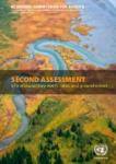
The Second Assessment of Transboundary Rivers, Lakes and Groundwaters is the most comprehensive, up-to-date overview of the status of transboundary waters in the European and Asian parts of the UNECE region. It covers more than 140 transboundary rivers, 25 transboundary lakes and about 200 transboundary groundwaters. It has been prepared upon request by the Sixth “Environment for Europe” Ministerial Conference as an input for the Seventh Ministerial Conference in Astana in September 2011.
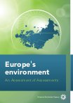
In support of the 2011 Ministerial Conference, the European Environment Agency, supported by UNECE, has prepared a Europe's environment — An Assessment of Assessments (EE-AoA). This assessment of assessments focuses on the two themes of the Astana conference: water and related ecosystems, and green economy. What progress is being made? Is the right information available to be able to tell? Are the correct approaches to assess what is known being used to support the policy process? Given the volume of environmental reports, indicators and data available a huge amount seems to be known about these issues. But is all this informing the policy process effectively, and is the best being done with the resources available for assessment? The aim of this AoA is to investigate these issues by assessing the assessments: cataloguing what exists, reviewing what is in them and analysing how they are put together. The overall objective is to improve the way in which the state of Europe's environment is kept under on-going review.
This book is intended as a basic information kit that tells "the story" of desertification, land degradation and drought at the global scale, together with a comprehensive set of graphics. The book indicates trends as they have taken place over the last decades, combining and connecting issues, and present priorities. It also provides information on the United Nations Convention to Combat Desertification (UNCCD) and how it works to forge a global partnership to reverse and prevent desertification/land degradation and to mitigate the effects of drought in affected areas in order to support poverty reduction and environmental sustainability.
The loss of land, freshwater and marine biodiversity is part of a wider wave of environmental change driven by ever expanding human activities, touching on virtually every component of our biosphere and the global climate system. This report by the Environment Management Group presents why biodiversity matters to sectors, and how the different policy sectors can help maintain biodiversity and ecosystem services.
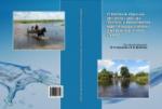
Monograph on water management on the upper Pripyat river between Belarus and Ukraine, prepared by the project team to present project results to the professional audience (Russian).
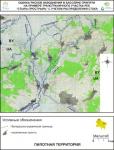
Mapping flood risks in the Styr-Prostyr basin part of the upper Pripyat basin
Action Programme to Improve Transboundary Cooperation and Sustainable Management of the Dniester River Basin (Dniester - III)
Russian e-book Russian e-book English
The maps are JPG images in Russian ( large files):
topography of the basin
areas affected by floods with probability 0.5% - 1% - 10% - 25%
infrastructure in the basin
infrastructure at risk from floods with probability 0.5% - 1% - 10% - 25%